Where Do Basking Sharks Feed?
Oct 04 2022
A question we’re often asked during our voyages is, Were are the sharks and how do we find them? Why they are not at a specific place at a specific time, and what the season was like. It’s almost an unanswerable question, as unlike cetaceans, basking sharks are fish and never need to come to the surface. They only do so to feed on zooplankton (Calanoid copepods) and so their presence at the surface, at a specific place and a specific time depends on a lot of factors
Basking sharks have spent summers around the Scottish coast for as long as human records go back, however exact numbers each year can vary. Our sightings data is based on surface observations i.e when we can see them from the boat. However considering they spend 90% of their time underwater, just because they are not on the surface doesn’t mean they aren’t there. Previous tagging & photo ID projects have proven site fidelity, meaning sharks returning to the same places, around the Hebridean islands year upon year. The data retrieved from satellite tags don’t rely on them being sighted at a specific place or time, which gives further insight into the shark’s behaviour when they are not seen on the surface. Though they do need to be seen on the surface to deploy these tags in the first place.
Basking sharks are usually seen between April & October with the peak being summer of July & August. However there can be plenty times in peak season where the sharks are absent and big aggregations in early/late season. Statistically ‘peak’ season has a higher average chance of them being present at the surface as there are usually more conditions present to allow them to be there.
We know that basking sharks move up and down in the water column a lot and follow the general vertical migration pattern of zooplankton. We also know that basking sharks are very sensitive to energy dynamics. Can you imagine how much energy it takes to swim with that huge mouth open? An easy way to describe this is that they feed when conditions are optimal. So if the current is very strong and the plankton concentrations are low then they will keep their mouth closed till the conditions improve. Say, once they find a thicker patch of plankton or perhaps swim with the current.
We managed to capture some great drone footage to illustrate this, hopefully, this will help you understand some of the elements that line up to see a shark on the surface. The drone has an amazing vantage point being able to see down through the water column, a view we can’t see from the boat. You do need to know roughly where the shark is first to be able to take advantage of this technology though!
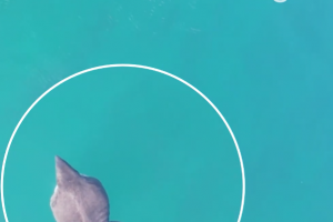
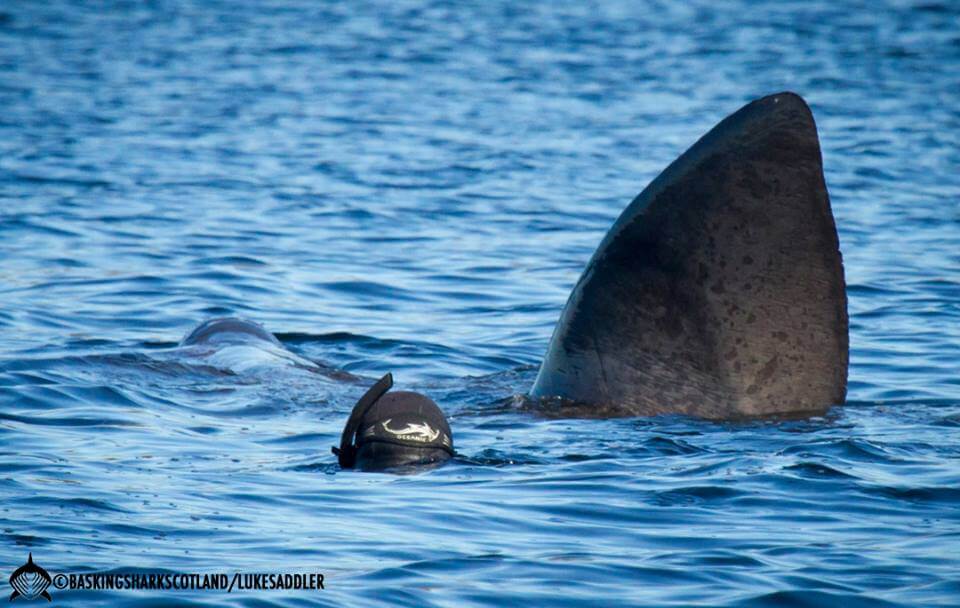
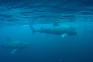
If you watch the shark in the video below, you can see it cruising around searching for an optimal feeding area to start with. Whilst doing this, it is under the surface of the water, mouth closed. This is their most streamlined and energy-efficient swimming position. It will stay like this till a better feeding area is found. Unless very close to the shark, or from a high vantage point, it is usually very difficult to see the shark from the surface when they are not breaking it.
The shark then comes across a thicker patch of plankton, it rises to a shallower depth, which allows the dorsal fin to break the surface of the water. This is the point that the shark can be seen from the boat, land, or wherever it is being observed from. Shortly after it opens its mouth and starts feeding, which is when the nose also breaks the surface allowing both the dorsal fin and nose to be seen. Usually, the shark is so high in the water column that the tail is also seen swishing side to side at this point.
Hopefully, this short video makes it easier to understand how plankton distribution and abundance affect the shark’s location in the water column. Which in turn affects their presence on the surface and how long they spend there. The main point is, no food – no fish!